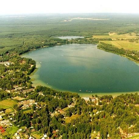
Silesia, Poland


Woiwodschaft Schlesien, Woiwodschaft Schlesien oder seinen polnischen Namen województwo śląskie, liegt im südlichen Teil Polens. Die Region grenzt an die Woiwodschaften: Opolskie, Łódzkie, Świętokrzyskie und Małopolskie und grenzt mit der Tschechischen und der Slowakischen Republik im Süden. Im Umkreis von 600 km von Katowice gibt es sechs europäische Hauptstädte: Warschau, Prag, Bratislava, Wien, Budapest und Berlin.

Es gibt 46 Grenzübergänge: 32 mit der Tschechischen Republik, darunter 29 Straßenübergänge, von denen 6 dienen Güterverkehr und 3 Bahnübergänge und 14 mit der Slowakischen Republik, darunter 13 Straßenübergänge, von denen 4 Service Güterverkehr und ein Schienen Kreuzung, sowie die "Katowice" International Airport.

Fast 79% der Bevölkerung lebt in der Region 71 Städten und rund 2.100 Dörfer. Die Region Śląskie ist 14. in Polen in Bezug auf Fläche belegt und 2. in Bezug auf die Gesamtbevölkerung pro Region. In diesem relativ kleinen Gebiet, abdeckt 12.300 qkm, 3,9% der Fläche Polens gibt es 4.900.000 Einwohner, 12,3% der Gesamtbevölkerung des Landes und ist damit die höchste Bevölkerungsdichte in Polen bei 382 Personen / km2 im Vergleich 122 Personen / km2 für ganz Polen und 116 Personen / km2 in der EU.

Die Woiwodschaft Schlesien ist in 36 Bezirke (Powiats) unterteilt. Dazu gehören 19 Stadtteile, die weit mehr als jede andere Provinz sind, und 17 Landkreise. Die Landkreise sind weiter in 167 Gminas unterteilt.

Subcarpathian Province, Poland


Podkarpackie, (polish – województwo podkarpackie) the Sub-Carpathian Province, located in the extreme south eastern corner of Polska. Woj Podkarpackie, means underneath the Carpathians.

The region’s neighbours are the Lublin Province to the north, the Little Poland Province, Malopolskie, to the west, and the Holy Cross Province, Świętokrzyskie Voivodeship, to the north west. The Province of Podkarpackie has an international border with Ukraine, 236 km border, on the east and Slovakia, 134 km border, on the south.

Podkarpackie occupies an area of 17,900 sq km (5.7% of the country’s area) and has a population of about 2.1 million people (5.5% of the country’s population). The capital of the region is Rzeszów with a population of 165,000, there are 45 towns and almost 2,200 villages, divided into 20 rural and 4 town districts. Arable lands in the region are: 945.6 ha, which constitutes 52.8% of the region’s total area.

The province of Podkarpackie includes the plains of the Sandomierz Valley in the Carpathian foothills of the Low Beskid Mountains and the Bieszczady National Park. The region is mostly hilly or mountainous except for its north western corner which is rather flat. It is one of the most wooded Polish provinces covering about 35.9% of the total area of the region.


The Carpathian Mountains or Carpathians are a range of mountains forming an arc of roughly 1,500 km across Central Europe and Eastern Europe, making them the largest mountain range in Europe.

Wislok is a river in south-eastern Poland, a tributary of the San River with a length of 205 kilometres, the 18th longest and has a basin area of 3,528 sq. km. totally within Poland. The Wislok valley could have been an important trade route and human settlements are thought to have existed as early as 9th or 10th century. The Wislok Valley was one of the strategically important Carpathian rivers that were bitterly contested in the battles on the Eastern Front during World War I.

The Wisloka river is a tributary of the Vistula river and has a length of 164 kilometres making it the 26th longest in Poland, the basin area is 4,110 sq. km. Tributaries of Wisloka river are; the Jasiolka, Tuszymka and the Wielopolka.

The San river in south eastern Poland and western Ukraine, and is a tributary of the Vistula River, with a length of 433 km and a basin area of 16,861 km. It is the 6th longest river in Poland. The San has its source in the Carpathian Mountains near the village of Sianky, Ukraine. It is located a few kilometres from the border with Poland, for approximately its first 50 km, in the south-eastern part of Bieszczady, and has an elevation of 900 metres, on the Polish-Ukrainian border.

Opole, Polen

#Opole, #Polen

Opole in southwest Poland in the province of Opole. Opole is a city on the Oder River (Odra). Once there was a Slavic settlement at the fork of the Oder and the Mlynowka Canal.

It has a population of 125,992 in June 2009 and is the capital city of Opole, Opole Province, and also the seat of Opole County.

Opole is the historical capital of Upper Silesia. Today, many German Upper Silesians and Poles of German ancestry live in the Opole region are in the city itself, Germans make up less than 3% of the population.

It became a bulwark and a city like from the 13th century and the capital of the Duchy of Opole was later. Part of Bohemia from 1528 and under the control of the Habsburgs from 1532 to 1742. In 1742, in the hands of the Prussians, and at the outbreak of the Second World War it had about 50,000 inhabitants passed Opole. Only in 1945 it became part of Poland and in 1950 was named as the capital of the region.

A major flood in July 1997 placed 70% of the city under water.

Most large cities in Poland seam, an ancient town and Opole is no exception, located at the mouth of the canal, surrounded by the Piast Tower, which was built in the 13th century, dominates to replace a former stronghold. There is also an amphitheater and a pond with the castle together.

Opole has a large industrial center with three cement mills, a power plant and chemical equipment and metallurgical factories. There are two main educational institutions: University of Opole University of Technology.
>

Mazowieckie, Poland


Mazowieckie Voivodeship Masovian or in Poland, located in the center of Poland in the great central plain between the Warta and Vistula Rivers. Located Mazowieckie is a low-lying area and is the largest of the Polish regions run both in terms of area, 35,000 square kilometers and the population, 5 million Menschen.Flüsse through the region, the Vistula (Wisła), Bug, Narew, Pilica and Wkra , Especially coniferous forests cover about 20% of the province.
There are 159 municipalities and more than 9400 villages and the province is administratively divided into 38 rural Powiats and 4 districts.
The boundaries are formed by the former provinces of Lodz, Wroclawek and Brodnica in the west, to the Belarusian border to the east, with the capital of Poland, Warsaw in the middle. The area was originally inhabited by two western Slavic tribes, and the Masurian Kuyavians. The Masurian occupied the area between the Bug and the Vistula. During the 15th and 16th century the tribe wandered in the forests of western Lithuania, in particular, Podlaskie, let others in the Duchy of Prussia, the Masurian Lake District, which lies to the north of Mazovia.


Culture

The year Dionizje International Theatre Meeting will be held in Ciechanów in May and the International Folklore Festival known as Kupalnocka in June. The Kurpie Forest in the northeast of the province is home to many ethnic events. There are theaters, the National Philharmonic, National Opera, the National Library and the National Museum in Warsaw.

Tourism and Nature

Warsaw most visitors to Poland and the region is well with historical sites for tourists bestückt.Kampinos National Park is one of the largest national parks in Poland with its virgin forests, sand dunes and Marschland.Mit its unique Old Town, appear on the list of UNESCO World Heritage.

For many foreign tourists the Mazowieckie Province is the region of green meadows and natural landscapes, where you can relax and door life. If you enjoy bird watching, the region has many places for you to visit. It is said that every fourth European stork lives in Poland nests perched on the roofs of the houses in the Masovian countryside.


Lesser Poland - Lesser Poland, Poland

Kleinpolen - Polen


Województwo Małopolskie - Lesser Poland Voivodeship was created in 1989 and is located in the south of Poland. The province is located in the area of ​​historic Little Poland (Malopolska).
The region of Silesia in the West, Province of Holy Cross in the north, Subcarpathian Voivodeship to the east, and the nation of Slovakia to the south. Most of the province is able Vistula river basin. (A province, also spelled province, Vojvodina or vojvodina, Polish: województwo).
The Tatra, Pieniny and Beskid Mountains on the border with Slovakia, are part of the Carpathian Mountains and some of Europe's most beautiful mountains. They are known as Poland's winter ski resort.
Lesser Poland Province includes 22 powiats (districts), including 3 urban ones. These in turn are in 182 municipalities. It has an area of ​​15,100 square kilometers and a population of 3.2 million people, Krakow (Cracow) is the capital of the region. Lesser Poland has 59 towns and 5,500 villages across the region.


Tourismus Kleinpolen

The old capital of Poland, Krakow (Cracow) is a major tourist destination in Europe, but the mountains in the south were drawing skiers for many years and hiking in summer. There are four national parks and many reserves, which are located in the region.
Classified the salt mine in Wieliczka, pilgrimage Kalwaria Zebrzydowska and Krakow's Old Town by UNESCO of the most precious sites of world cultural heritage.
Wadowice was the birthplace of Pope John Paul II, where there is a museum dedicated to the late Pope's childhood.
Tourism is covered connected in much more detail on each page with the cities, towns and villages of Little Poland.


Lublin, Poland


 Geographical Location
The Lublin Lublin Voivodeship and is one of the largest Polish regions, with respect to the surface is in third place, and covers an area of ​​25.15 square kilometers, representing 8% of the total area of ​​the country. Lublin is located in the central-eastern part of Poland, with national borders Belarus to the east and Ukraine. This is also the border of the European Union. Adjacent to the Lublin Voivodeship, the areas of Subcarpathian, Holy Cross, Mazovia and Podlasie.
In the past, most of Lublin, with the exception of Chelm area of ​​the historic province, "Little Poland" belonged. Use the Chelm region to be part of the province Halicz Ruthenia. The river Wieprz runs through the province and the rivers Vistula and Bug mark the regions borders. Lubelski has two national parks: the Polesie and Roztoczański.Population and Administrative Divisions
In the province of Lublin in March 2008, the population was 2,164,600 people with the urban population, 46.5% of the population were 51.5% female. It has 40 towns and 4,200 villages. The Lublin Voivodeship is divided into 20 powiats (districts). These in turn are divided into 213 municipalities (gminas). Lublin, Biala Podlaska, Chelm and Zamosc have the status of local councils (neighborhoods).Border crossings
In the region of Lublin, there are six road, four cars and two air international border crossings, which are hold on behalf of the Governor of Lublin forums of the crossings in Chelm. The source of funding for regular maintenance of road crossings are the responsibility of the state, while investments for improvement, both by the state and by means of measures by the European Union finanziert.Internationale airports can be found at: Swidnik and Biala Podlaska. International road access to the border with Belarus to Kukurykach, Terespol and Slawatycze away. International railway boundaries in Terespol. On the Ukrainian border intersection Dorohuskor, Hrebenne and Zosinie stand with level crossing at Dorohuskor, Hrubieszow and Hrebenne.Agriculture
The Lublin province has good growing conditions for agricultural production with good quality especially sand fertile soil. The region is a major producer of cereals, especially wheat, oats and Gerste.Kartoffeln, sugar beet, vegetables, hops, tobacco is grown in Urszulin. The region is also a major producer of milk, honey and herbs. Lubelski Province is one of the leading Polish manufacturer of soft fruit, especially raspberries. It is also known for breeding pigs, cattle and horse stud Janow Podlaski with the famous.


Dolnośląskie, Poland


The province of Alberta Dolnośląskie coat of arms. (Polish: województwo dolnośląskie) in southwestern Poland situated It is bordered by the Czech Republic to the south, the border 432 km long and Germany (Saxony) in the west, 80 is the state border km long. Lower Silesia has an area of ​​about 20,000 square kilometers and is 6.4% of the total land area of ​​the country of Poland. About 7.6%, nearly 3 million people of Polish population live in Lower Silesia and the density of population is about 20 percent higher than the average for the country.

There are 91 villages and towns in Lower Silesia, which 10.2% of all the places in Poland. Wrocław is the capital city has about 634,000 inhabitants and is an important economic, scientific and cultural center, which has a growing impact on other regions in Poland.

There are a variety of companies, including foreign-funded enterprises, and continue to increase over the previous year to help reduce the unemployment rate in the region.

Dolnośląskie is a region full of history, mysteries and unsolved mysteries. Four kings in the past centuries were the opportunity for the region to fight and the area was also the scene of numerous wars and invasions.

Zakopane, Poland


Zakopane, City, Małopolskie województwo (province), south-central Poland. The city is in the Carpathian Mountains near the Slovakian border. Its location at the foot of the Alps as Tatra makes it away to a great winter sports and fitness center. On good rail and highway routes, also Zakopane serves as a cultural center for the region. The Chałubiński Memorial Tatra Museum, ethnographic and geological displays, was opened in 1888, Zakopane is also the site of the Union of Polish art exhibition hall, and it has some remarkable monuments and a public garden.Settlement options were granted in 1578, but has not become Zakopane Polish character until 1889, when a Polish patriot Władysław Zamoyski bought the field at a public auction by a Berlin businessman. In 1924, he donated this property to form the basis of the Tatra National Park. The growth of the city began in 1889 with the extension of a railway line to Zakopane; it was the creation of the park and the influx of visitors through the area of ​​winter sports and pulled stimulates Mountain opportunities. Pop. (2002) 28 203; (2006 est.) 27,486.


Poland is a country with a great variety of landscapes, a place where you can experience all four seasons. This offers visitors many opportunities for adventure and a variety of activities, whether the mountains, lakes, rivers, or the beaches you will find something that suits you.If you see something you like or want to know more about us at the activity provider more.Whatever activity you do, if you want to advertise your activities on Zakopane Travel books and guides or this Polish leader, you can send it to us.


Attractions in Zakopane
Poland is a large variety of attractions for tourists to visit a country, a place where you can experience to see all kinds of places. This offers visitors many opportunities for learning about Polska, if you enjoy the many monuments, historic churches and buildings, history of places and modern attractions, you will find something that suits you.

If you see something you like or want to know more about us at attracting more providers.

Whatever attraction you run if you want to advertise your attraction to Zakopane Travel books and guides or this website please send us.
 

West Pomerania, Poland

West Pomeranian, Poland West Pomeranian Voivodeship, województwo (province) in north-western Poland. Created in 1999 as part of the reorganization of the country of Poland, the earlier (1975-1998) provinces comprising Szczecin and Koszalin and parts of the former provinces of Gorzów, Pila and Slupsk. It is bordered by the Baltic Sea to the provinces Wielkopolskie and on the east by the province of Pomerania, Lubusz in the south and to the west by Germany. The provincial capital is Szczecin. Area 8,843 square miles (22,902 km ²). Pop. (2002) 1,698,214.

Szczecin


 West Pomeranian is a low-lying region with moraine hills, river valleys and over 1,500 lakes, including some former bays are dotted. In the north of the Szczecin and Koszalin are coastal countries, with the big Szczeciński Lagoon, while the Pomeranian Lake District is located in the central and southern portions. The province's most important rivers are the Oder (Odra), Rega, Parsęta, Ina and Drawa. West Pomeranian is one of the most forested provinces of Poland, and forests cover a third of the total area. The climate is one of the mildest in Poland and is influenced by the proximity of the Baltic Sea. The mean annual temperature is 47.3 ° F (8.5 ° C), and the average annual rainfall ranges from 22 inches (550 mm) in the east up to 30 inches (750 mm) in the west.

West Pomeranian has one of the lowest population density among the provinces. Two thirds of the population is urban, and the largest cities are Szczecin, Koszalin, Stargard and Kolberg. Ethnic minorities (especially Ukrainians after the Second World War sold) live in rural areas.


Stargard 


Although almost half of the country is as an agricultural area-with major crops as corn, canola, fodder and sugar beet, the region has used a predominantly maritime industry. The Port of Szczecin is connected from the Oder to Swinoujscie, a port city on the Baltic Sea. Together, they form the largest port complex in Poland. The SSN is second only to the Gdansk. The most important industries are fishing and fish processing, chemicals, brewing, wood and furniture. Local hot springs are accessible from the geothermal plant in Pyrzyce. Main railway lines linking Szczecin with major Polish cities and Germany, while the port of Swinoujscie offers regular ferry connections with Sweden. There is an airport near Szczecin Goleniów.
Koszalin